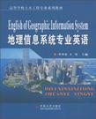
地理信息系统专业英语
2010-7
中南大学出版社
李朝奎,全斌 主编
200
地理信息系统专业英语是一门语言应用课程,其目的是为了提高学生阅读专业英语文献的能力,从而更好地与国际GIS界进行沟通。GIS是信息学与地学交叉形成的一门新兴学科,起源于加拿大。GIS在我国经历了起步、发展、成熟三个阶段。到2009年,GIS教育在我国经历了二十年的发展历程。虽然取得了举世瞩目的成就,但与北美、欧洲相比,仍有相当的距离。为了跟踪GIS科学的国际发展前沿,推动GIS课程教学与国际接轨,培养具有国际竞争力的人才,填补GIS学科领域的教材空白,教材编委会组织编写了这本GIS专业英语教材。教材从GIS的不同侧面选择相关题材,组成16个学习单元,每个单元学习时数最低为2小时,即最低授课时数为32学时。1单元至14单元介绍GIs的相关概念,15单元至16单元介绍GIS的应用。每个单元分为课文、新单词、词组、注释、练习、参考译文、练习参考答案七个部分,便于教师授课选择和学生自学。本书侧重GIS基本概念与专业术语的英语表达,强调典型语句的分析与译文技巧。为了使学生了解英文习惯表达,本书尽量选择原版英文作为学习内容。本书可以作为GIs本科专业及硕士专业的通识教材,也可供地理、资源环境、测绘等相关专业学习参考。本书由湖南科技大学李朝奎教授、全斌副教授组织编写与统稿。中南林业科技大学张贵教授、湖南师范大学杨波副教授、华北水利电力学院李春静副教授、江西师范大学龚俊博士、海南师范大学谢跟踪副教授对全书进行了校对,并提出宝贵修改意见。本书在编写过程中得到了湖南科技大学硕士研究生路立娟、郑拴宁、鲍振洪、陈良、李吟、郭翔等同学的支持,在此一并表示感谢,同时对书中的引文作者表示衷心感谢。由于水平有限,书中定有不当和错漏之处,恳请广大读者批评指正!
本书是面向高等院校的地理信息系统本科专业和地图学与地理信息系统硕士研究生专业开设的专业英语教程。全书共分16个单元,整体内容分为GIS概念、GIS技术和GIS应用三大部分。每个单元包含Text,New words,Phrases,Notes,Exercises,Translation to Text and Key to Exercises等内容,便于教师授课和学生自学。Unit 1至Unit 3主要介绍GIS的定义及应用领域,Unit 4至Unit 5介绍等离线及其精度,Unit 6介绍三维的概念,Unit 7介绍数据格式转换,Unit 8介绍影像分类,Unit 9介绍GIS的时间响应概念,Unit 10介绍地图投影,Unit 11介绍GIS改变地理学,Unit 12介绍地理教育与专业发展,Unit 13介绍行为地理学,Unit 14介绍GIs的最重要组成,Unit 15至Unit 16介绍GIS在土地变化与评估中的应用。本书侧重专业基本慨念与方法,强调专业概念的思维与表达。为便于学生掌握和加深理解课程内容,每一章均提供了练习题和参考答案。 本书可作为地理信息系统本科专业和研究生专业的通识教材,同时可供相关专业的生产技术人员参考。
Unit 1 Definitions of GIS New Words Phrases Notes Exercises Translation to Text Key to ExerciseUnit 2 Introduction to GIS New Words Phrases Notes Exercises Translation to Text Key to ExerciseUnit 3 Application of GIS New Words Phrases Notes Exercises Translation to Text Key to ExerciseUnit 4 Contours New Words Phrases Notes Exercises Translation to Text Key to ExerciseUnit 5 Contour Accuracy New Words Phrases Notes Exercises Translation to Text Key to ExerciseUnit 6 The Third Dimension New Words Phrases Notes Exercises Translation to Text Key to ExerciseUnit 7 Data Format Conversions New Words Phrases Notes Exercises Translation to Text Key to ExerciseUnit 8 Image Classification New Words Phrases Notes Exercises Translation to Text Key to ExerciseUnit 9 GIS in Response Time Analysis New Words Phrases Notes Exercises Translation to Text Key to ExerciseUnit 10 Map Projections New Words Phrases Notes Exercises Translation to Text Key to ExerciseUnit 11 Changing the Face of Geography: GIS and the IGU New Words Phrases Notes Exercises Translation to Text Key to ExerciseUnit 12 Geography Education and Professional Development New Words Phrases Notes Exercises Translation to Text Key to ExerciseUnit 13 GIS - Geography in Action New Words Phrases Exercises Translation to Text Key to ExerciseUnit 14 The Most Important Part of a GIS New Words Phrases Notes Exercises Translation to Text Key to ExerciseUnit 15 Land Suitability Assessment in Fujian Province, China New Words Phrases Notes Exercises Translation to Text Key to ExerciseUnit 16 New Words Phrases Notes Exercises Translation to Text Key to Exercise
插图:A GIS works by providing a way to capture or input data, store, retrieve andmanage the data, manipulate and analyze the data, and finally a way of displaying thatdata as a document. Let' s take a closer look at each of these aspects of GIS.Data input: All GIS data has to be in a digital format so whether it' s a report, aphoto, a map, or information gathered in the field, it has to be made digital.Obtaining geographic data to insert into a GIS is a large subject in which includes anumber of different approaches. One of the most common ways to collect spatialgeographic data is to perform a physical survey. This includes surveying the land,underwater areas, and underground features of the earth (which are referred to as fieldsurvey, hydrographic survey and mining survey respectively).Basic forms of data input include : Typing: Reports, survey documents,population statistics, etc. , all have to be entered into the computer preferably in adata base format or as tabular data. Scanning: Paper maps such as topographic maps,aerial photographs, remotely sensed images if not already in a digital format need tobe scanned and then georeferenced or georectified. When a picture or a map or anaerial photo is georeferenced it will open in a GIS program in the right place on amap in relation to another map objects being viewed. They will be in the properplace spatially. Digitizing: Currently digitizing is the most common method forconverting existing maps and images into digital form. Digitizing is basically tracingpoints, lines, or areas from a paper map, or aerial photo so that instead of aphotograph or a raster image, there is now a digital line graphic or vector file.
《地理信息系统专业英语》:高等学校土木工程专业系列教材

书没看,当当买书不错,就是当当的系统慢。
比较有用,相当于词典了
是一本学习GIS专业英语的好书
在GIS学科中,比较欠缺的时外语教材和双语教材,这不说不是一本很好的入门级教材。
这本专业外语很不错,在便宜一点就好了啊,呵呵
本書通過單元講解模式分析地學專業英語,對於剛入門的英語學者還可以,這本專業英語講解很淺,希望大家多做參考!
这本书真心不推荐,语法上都说不过去
全英文的,看起还是有一点吃力,好书哟!!!